

3D City Models for Geospatial Transportation Data
13th January 2021
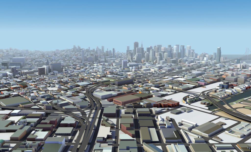
HERE Technologies, a leading location data and technology platform, has unveiled high-fidelity, 3D models of 75 city centers around the world to give software developers the geospatial data needed to build real-world visualizations of cities. With HERE Premier 3D Cities, last-mile delivery drivers can navigate dense cities with maps that highlight precise building dimensions and entry points along their delivery routes. Telecommunications companies can optimize their buildouts of 5G networks in 3D and urban planners and emergency responders can build digital twins for better land use analysis and disaster readiness simulations.
HERE Premier 3D Cities contain rich data layers and attributes that are aligned to physical geometry and terrain. Each structure is indexed, addressable, and accurate in terms of physical location, volume size, elevation and façade color. Currently, the Audi A8 luxury sedan’s modular infotainment platform (MIB2+) integrates HERE 3D city models, providing drivers with the latest navigation user interface and lane-level guidance experiences.
“With the enterprise developer in mind, HERE has captured, indexed and mapped the world’s major road networks and urban centers in 3D,” said Jørgen Behrens, Senior Vice President and Chief Product Officer at HERE Technologies. “We’re excited to see how these unique 3D city models open up a world of possibilities and value for businesses. They are the building blocks to create accurate, sub-meter augmented reality applications that are transforming supply chains, transportation and mobility networks, and overall consumer experiences.”
The indexed and addressable structures within HERE Premier 3D Cities allow developers to search and highlight individual buildings, attach additional metadata to the structures, and apply advanced rendering techniques including CGI applications. HERE Premier 3D Cities are available in Cesium/OGC 3D Tiles to support seamless integration. Each kilometer of data is stored in small-sized tiles for efficient streaming and rendering. Sample datasets of London, Berlin and Munich are currently available on AWS Data Exchange.
HERE has mapped 196 countries and collects more than 28 terabytes of terrestrial LiDAR data every day. HERE Premier 3D Cities are created with multiple sources – including LiDAR, optical and satellite imagery – and decades of cartographic expertise and AI/Machine Learning applications the company has developed to deliver industry leading location-based services to enterprises globally.